Geolocate

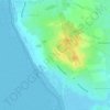
Dockkoog topographic map

Click on the map to display elevation.

About this map

Name: Dockkoog topographic map, elevation, terrain.

Location: Dockkoog, Porrenkoog, Husum, Kreis Nordfriesland, Schleswig-Holstein, 25813, Deutschland (54.46989 9.00694 54.48989 9.02694)

Average elevation: 0 m

Minimum elevation: -5 m

Maximum elevation: 8 m

Other topographic maps

Click on a map to view its topography, its elevation and its terrain.
Gear up for your next adventure:

📱Phone Mounts for Hiking - Secure mounts to carry your phone on trails
🌦️Portable Weather Meters - Handheld tools for monitoring weather conditions
🔥Reusable Hand Warmers - Maintain dexterity in your fingers for precise map handling
🧼Technical Clothing Wash - Special soap to clean and restore waterproof membranes
📦Compression Sacks - Reduce backpack volume efficiently

As an Amazon Associate, this site earns from qualifying purchases at no extra cost to you.