
Mopa topographic map
Interactive map
Click on the map to display elevation.
About this map
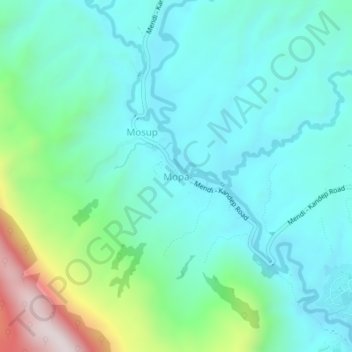
Name: Mopa topographic map, elevation, terrain.
Average elevation: 1,908 m
Minimum elevation: 1,732 m
Maximum elevation: 2,539 m
Other topographic maps
Click on a map to view its topography, its elevation and its terrain.
Sunda
Papua New Guinea > Southern Highlands > Mendi District > Sunda
Sunda, Mendi District, Southern Highlands, Highlands Region, Papua New Guinea
Average elevation: 1,911 m