Geolocate

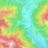
Musi / Mužac topographic map

Click on the map to display elevation.

About this map

Name: Musi / Mužac topographic map, elevation, terrain.

Location: Musi / Mužac, Udine, Friuli – Venezia Giulia, Italy (46.29286 13.25322 46.33286 13.29322)

Average elevation: 1,068 m

Minimum elevation: 402 m

Maximum elevation: 1,840 m

Other topographic maps

Click on a map to view its topography, its elevation and its terrain.

Cercivento

Italy > Friuli – Venezia Giulia > Udine

Average elevation: 1,034 m

Ovaro

Italy > Friuli – Venezia Giulia > Udine

Average elevation: 1,066 m

Torviscosa

Italy > Friuli – Venezia Giulia > Udine

Average elevation: 3 m

Preone

Italy > Friuli – Venezia Giulia > Udine

Average elevation: 968 m

Sutrio

Italy > Friuli – Venezia Giulia > Udine

Average elevation: 897 m

Gear up for your next adventure:

📷Camera Straps - Secure straps for carrying cameras while walking
🚶Walking Pedometers - Simple distance tracking for casual trail walkers
🧗Locking Carabiners - Secure gear to your pack or for light technical use
📷Outdoor Action Cameras - Cameras designed for hiking and adventure
🛌Sleeping Mats - Insulated mats for comfortable outdoor sleeping

As an Amazon Associate, this site earns from qualifying purchases at no extra cost to you.