
Wairau Creek topographic map
Interactive map
Click on the map to display elevation.
About this map
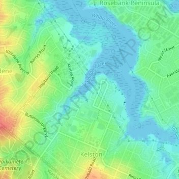
Name: Wairau Creek topographic map, elevation, terrain.
Location: Wairau Creek, Kelston, Whau, Auckland, 0602, New Zealand (-36.89693 174.65837 -36.88662 174.67222)
Average elevation: 20 m
Minimum elevation: 0 m
Maximum elevation: 63 m