
Hagerman topographic map
Interactive map
Click on the map to display elevation.
About this map
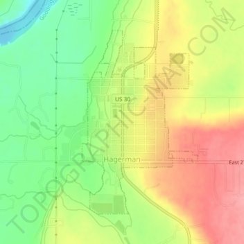
Name: Hagerman topographic map, elevation, terrain.
Location: Hagerman, Gooding County, Idaho, 83332, United States (42.80603 -114.90470 42.82636 -114.88724)
Average elevation: 900 m
Minimum elevation: 851 m
Maximum elevation: 948 m
Other topographic maps
Click on a map to view its topography, its elevation and its terrain.
Malad Gorge State Park
United States > Idaho > Gooding County
Malad Gorge State Park, Gooding County, Idaho, 83332, United States
Average elevation: 958 m
Ritter Island
United States > Idaho > Gooding County
Ritter Island, Gooding County, Idaho, United States
Average elevation: 943 m
Wendell
United States > Idaho > Gooding County > Wendell
Wendell, Gooding County, Idaho, 83355, United States
Average elevation: 1,044 m
Bliss
United States > Idaho > Gooding County
Bliss, Gooding County, Idaho, United States
Average elevation: 962 m