
Thank you for supporting this site ❤️
Make a donation
Make a donation
Gear up for your next adventure:
As an Amazon Associate, this site earns from qualifying purchases at no extra cost to you.
Kianjai topographic map
Click on the map to display elevation.
Thank you for supporting this site ❤️
Make a donation
Make a donation
Gear up for your next adventure:
As an Amazon Associate, this site earns from qualifying purchases at no extra cost to you.
About this map
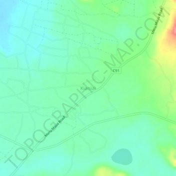
Name: Kianjai topographic map, elevation, terrain.
Location: Kianjai, Kianjai ward, Tigania West, Meru County, Kenya (0.14660 37.73000 0.18660 37.77000)
Average elevation: 1,395 m
Minimum elevation: 1,373 m
Maximum elevation: 1,453 m
Thank you for supporting this site ❤️
Make a donation
Make a donation
Gear up for your next adventure:
As an Amazon Associate, this site earns from qualifying purchases at no extra cost to you.