
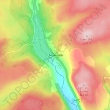
Llwyn-onn topographic map
Interactive map
Click on the map to display elevation.
About this map
Name: Llwyn-onn topographic map, elevation, terrain.
Average elevation: 356 m
Minimum elevation: 217 m
Maximum elevation: 459 m
Merthyr Tydfil County Borough trails, hiking, mountain biking, running and outdoor activities
Other topographic maps
Click on a map to view its topography, its elevation and its terrain.
Maerdy Park
United Kingdom > Wales > Merthyr Tydfil County Borough > Merthyr Tydfil
Average elevation: 223 m
Gelligaer Common
United Kingdom > Wales > Merthyr Tydfil County Borough > Trelewis
Average elevation: 309 m
Taf Fechan
United Kingdom > Wales > Merthyr Tydfil County Borough > Trefechan
Average elevation: 297 m