
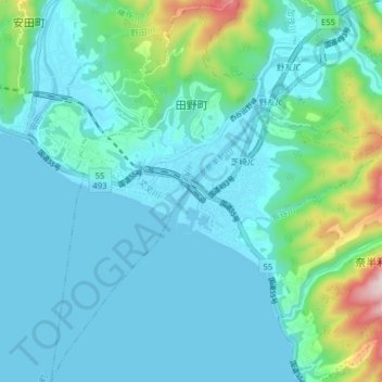
田野町 topographic map
Interactive map
Click on the map to display elevation.
About this map
Name: 田野町 topographic map, elevation, terrain.
Location: 田野町, 安藝郡, 高知县, 日本 (33.39392 133.98666 33.45950 134.03017)
Average elevation: 73 m
Minimum elevation: 0 m
Maximum elevation: 457 m
Other topographic maps
Click on a map to view its topography, its elevation and its terrain.