
Thank you for supporting this site ❤️
Make a donation
Make a donation
Gear up for your next adventure:
As an Amazon Associate, this site earns from qualifying purchases at no extra cost to you.
Chotilsko topographic map
Click on the map to display elevation.
Thank you for supporting this site ❤️
Make a donation
Make a donation
Gear up for your next adventure:
As an Amazon Associate, this site earns from qualifying purchases at no extra cost to you.
About this map
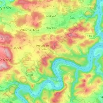
Name: Chotilsko topographic map, elevation, terrain.
Location: Chotilsko, okres Příbram, Central Bohemia, Czechia (49.72079 14.29942 49.78189 14.42881)
Average elevation: 366 m
Minimum elevation: 264 m
Maximum elevation: 510 m
Thank you for supporting this site ❤️
Make a donation
Make a donation
Gear up for your next adventure:
As an Amazon Associate, this site earns from qualifying purchases at no extra cost to you.