
栾川乡 topographic map
Interactive map
Click on the map to display elevation.
About this map
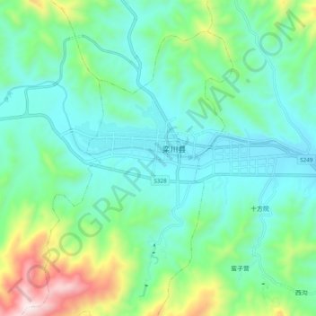
Name: 栾川乡 topographic map, elevation, terrain.
Location: 栾川乡, 城关镇, 栾川县, 河南省, 471500, 中国 (33.74230 111.57180 33.82230 111.65180)
Average elevation: 925 m
Minimum elevation: 714 m
Maximum elevation: 1,610 m