
Makgadikgadi Pans Game Reserve topographic map
Interactive map
Click on the map to display elevation.
About this map
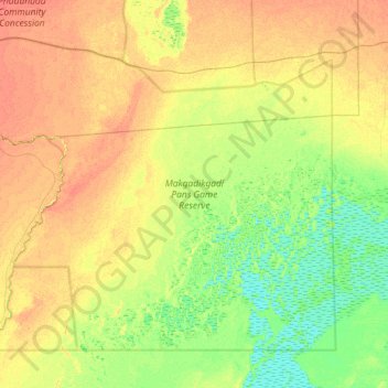
Name: Makgadikgadi Pans Game Reserve topographic map, elevation, terrain.
Location: Makgadikgadi Pans Game Reserve, Central District, Botswana (-20.83420 24.26104 -20.18058 25.12752)
Average elevation: 917 m
Minimum elevation: 902 m
Maximum elevation: 934 m
Other topographic maps
Click on a map to view its topography, its elevation and its terrain.
Boteti River
Boteti River, Central District, Botswana
Average elevation: 914 m
Selebi Phikwe
Botswana > Central District > Selebi Phikwe
Selebi Phikwe, Central District, Botswana
Average elevation: 863 m
Letlhakane
Botswana > Central District > Letlhakane
Letlhakane, Central District, NULL, Botswana
Average elevation: 990 m