
Quarter 1 of District 7 topographic map
Interactive map
Click on the map to display elevation.
About this map
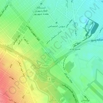
Name: Quarter 1 of District 7 topographic map, elevation, terrain.
Average elevation: 994 m
Minimum elevation: 967 m
Maximum elevation: 1,037 m
Other topographic maps
Click on a map to view its topography, its elevation and its terrain.
Mountain Park
Iran > Razavi Khorasan > Mashhad County > Mashhad
Mountain Park, District 9, Mashhad, بخش مرکزی شهرستان مشهد, Mashhad County, Razavi Khorasan, Iran
Average elevation: 1,282 m
Shahid Razavi
Iran > Razavi Khorasan > Mashhad County > Mashhad
Shahid Razavi, Quarter 1 of District 11, District 11, Mashhad, بخش مرکزی شهرستان مشهد, Mashhad County, Razavi Khorasan, Iran
Average elevation: 1,048 m