Geolocate

Withcott topographic map

Click on the map to display elevation.

About this map

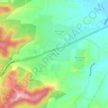
Name: Withcott topographic map, elevation, terrain.

Location: Withcott, Lockyer Valley Regional, Queensland, Australia (-27.57459 152.00662 -27.53459 152.04662)

Average elevation: 286 m

Minimum elevation: 200 m

Maximum elevation: 450 m

Gear up for your next adventure:

🧴Tick Removal Tools - Small, essential health tool for UK woodland and moorland
🧥Packable Down Jackets - Lightweight warmth that compresses small in your bag
🧊Personal Water Filters - Drink safely from mountain streams marked on your map
🖼️Topographic Map Art - Decorative 3D-effect posters of famous UK peaks and regions
👖Packable Overtrousers - Quick-deploy rain protection for legs in sudden storms

As an Amazon Associate, this site earns from qualifying purchases at no extra cost to you.