
Thank you for supporting this site ❤️
Make a donation
Make a donation
Gear up for your next adventure:
As an Amazon Associate, this site earns from qualifying purchases at no extra cost to you.
Palca topographic map
Click on the map to display elevation.
Thank you for supporting this site ❤️
Make a donation
Make a donation
Gear up for your next adventure:
As an Amazon Associate, this site earns from qualifying purchases at no extra cost to you.
About this map
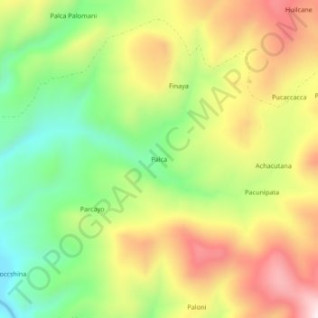
Name: Palca topographic map, elevation, terrain.
Location: Palca, Callalli, Provincia de Caylloma, Arequipa, Perú (-15.52202 -71.18994 -15.48202 -71.14994)
Average elevation: 4,505 m
Minimum elevation: 4,245 m
Maximum elevation: 4,801 m
Thank you for supporting this site ❤️
Make a donation
Make a donation
Gear up for your next adventure:
As an Amazon Associate, this site earns from qualifying purchases at no extra cost to you.