Geolocate

Magara topographic map

Click on the map to display elevation.

About this map

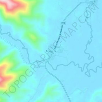
Name: Magara topographic map, elevation, terrain.

Location: Magara, Roxas, Palawan, Mimaropa, Philippines (10.23800 119.18864 10.27800 119.22864)

Average elevation: 46 m

Minimum elevation: 0 m

Maximum elevation: 455 m

Other topographic maps

Click on a map to view its topography, its elevation and its terrain.

Coconut Beach

Philippines > Palawan > Roxas

Average elevation: 23 m

Long Beach

Philippines > Palawan > Roxas > San Isidro

Average elevation: 4 m

Purao Island

Philippines > Palawan > Roxas

Average elevation: 0 m

Stanlake Island

Philippines > Palawan > Roxas

Average elevation: 0 m

Boayan

Philippines > Palawan > Roxas

Average elevation: 12 m

Gear up for your next adventure:

🧴Tick Removal Tools - Small, essential health tool for UK woodland and moorland
🎒Hiking Backpacks - Comfortable backpacks for day hikes and multi-day treks
🧰First Aid Kits - Essential safety kits for outdoor activities
🥄Titanium Camping Sporks - The ultimate lightweight utensil for trail meals
🧢Waterproof Hiking Hats - Keep the rain off your face while studying topographic maps

As an Amazon Associate, this site earns from qualifying purchases at no extra cost to you.