
Turț topographic map
Interactive map
Click on the map to display elevation.
About this map
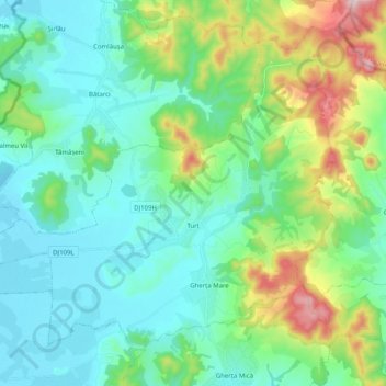
Name: Turț topographic map, elevation, terrain.
Location: Turț, Satu Mare, Roumanie (47.94250 23.08620 48.05921 23.28797)
Average elevation: 264 m
Minimum elevation: 127 m
Maximum elevation: 719 m