
Röbel/Müritz topographic map
Interactive map
Click on the map to display elevation.
Röbel/Müritz
Die Stadt Röbel liegt in der Mecklenburgischen Seenplatte an einem südwestlichen Ausläufer der Müritz auf einer Höhe von 65 m ü. NHN.
About this map
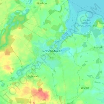
Name: Röbel/Müritz topographic map, elevation, terrain.
Average elevation: 74 m
Minimum elevation: 58 m
Maximum elevation: 113 m