Geolocate

Renhuai topographic map

Click on the map to display elevation.

About this map
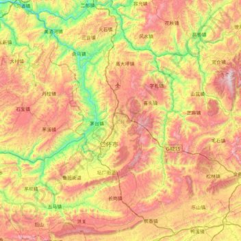
Name: Renhuai topographic map, elevation, terrain.

Location: Renhuai, Zunyi, Guizhou, China (27.55586 105.99741 28.17255 106.59880)

Average elevation: 996 m

Minimum elevation: 324 m

Maximum elevation: 1,828 m

Gear up for your next adventure:

📦Compression Sacks - Reduce backpack volume efficiently
🧭GPS Trackers - Tracking devices for safety and navigation
🗺️Scratch-off Peak Maps - Track your progress climbing Munros or Wainwrights
⌚Altimeter Watches - Watches measuring altitude for mountain activities
🕶️Glacier Goggles - Maximum protection for high-altitude snow topography

As an Amazon Associate, this site earns from qualifying purchases at no extra cost to you.