
Elands topographic map
Interactive map
Click on the map to display elevation.
About this map
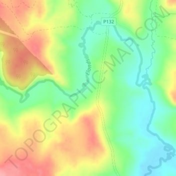
Name: Elands topographic map, elevation, terrain.
Average elevation: 1,315 m
Minimum elevation: 1,271 m
Maximum elevation: 1,368 m
Other topographic maps
Click on a map to view its topography, its elevation and its terrain.
Lotheni
RSA > KwaZulu-Natal > Impendle Local Municipality
Lotheni, Impendle Local Municipality, uMgungundlovu District Municipality, KwaZulu-Natal, RSA
Average elevation: 1,514 m
Elands
RSA > KwaZulu-Natal > Impendle Local Municipality
Elands, Impendle Local Municipality, uMgungundlovu District Municipality, KwaZulu-Natal, RSA
Average elevation: 1,315 m