
Thank you for supporting this site ❤️
Make a donation
Make a donation
Gear up for your next adventure:
As an Amazon Associate, this site earns from qualifying purchases at no extra cost to you.
Labbaikudikadu topographic map
Click on the map to display elevation.
Thank you for supporting this site ❤️
Make a donation
Make a donation
Gear up for your next adventure:
As an Amazon Associate, this site earns from qualifying purchases at no extra cost to you.
About this map
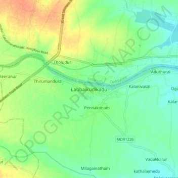
Name: Labbaikudikadu topographic map, elevation, terrain.
Location: Labbaikudikadu, Kunnam, Perambalur, Tamil Nadu, 621108, India (11.35242 78.98179 11.43242 79.06179)
Average elevation: 86 m
Minimum elevation: 71 m
Maximum elevation: 107 m
Thank you for supporting this site ❤️
Make a donation
Make a donation
Gear up for your next adventure:
As an Amazon Associate, this site earns from qualifying purchases at no extra cost to you.