
Salto Ángel topographic map
Interactive map
Click on the map to display elevation.
About this map
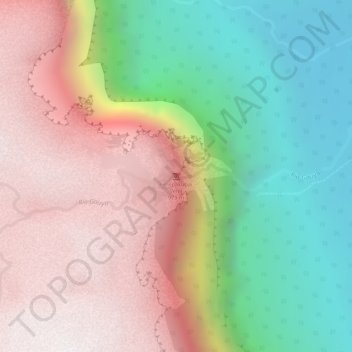
Name: Salto Ángel topographic map, elevation, terrain.
Average elevation: 1,177 m
Minimum elevation: 512 m
Maximum elevation: 1,803 m
Other topographic maps
Click on a map to view its topography, its elevation and its terrain.
Parroquia Gran Sabana
Venezuela > Estado Bolívar > Municipio Gran Sabana
Parroquia Gran Sabana, Municipio Gran Sabana, Estado Bolívar, 8011, Venezuela
Average elevation: 756 m