
Lessines topographic map
Interactive map
Click on the map to display elevation.
About this map
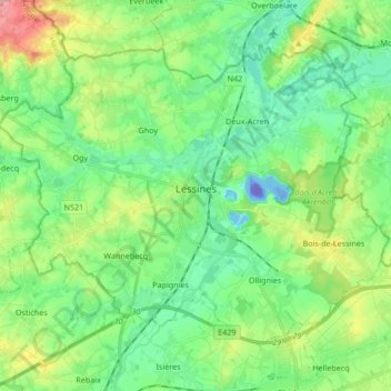
Name: Lessines topographic map, elevation, terrain.
Location: Lessines, Ath, Hainaut, Wallonie, Belgique (50.66940 3.74512 50.75161 3.91346)
Average elevation: 39 m
Minimum elevation: -103 m
Maximum elevation: 134 m
Other topographic maps
Click on a map to view its topography, its elevation and its terrain.