
Titford topographic map
Interactive map
Click on the map to display elevation.
About this map
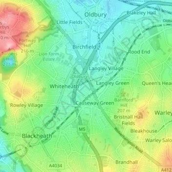
Name: Titford topographic map, elevation, terrain.
Average elevation: 181 m
Minimum elevation: 139 m
Maximum elevation: 270 m
Other topographic maps
Click on a map to view its topography, its elevation and its terrain.
Causeway Green Park
United Kingdom > England > Sandwell > Causeway Green > The Ashes
Average elevation: 184 m