
Ibanda topographic map
Interactive map
Click on the map to display elevation.
About this map
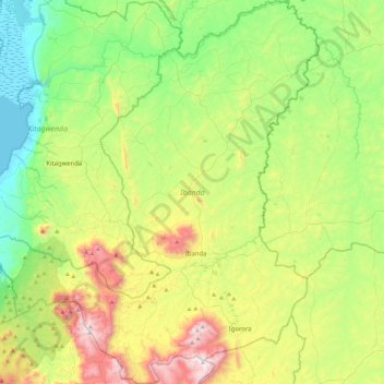
Name: Ibanda topographic map, elevation, terrain.
Location: Ibanda, Western Region, Uganda (-0.28629 30.24602 0.16383 30.64005)
Average elevation: 1,329 m
Minimum elevation: 914 m
Maximum elevation: 2,168 m
Other topographic maps
Click on a map to view its topography, its elevation and its terrain.