
De Mars topographic map
Interactive map
Click on the map to display elevation.
About this map
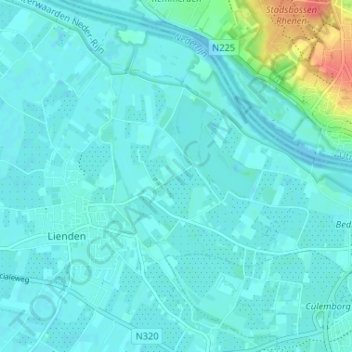
Name: De Mars topographic map, elevation, terrain.
Average elevation: 10 m
Minimum elevation: 3 m
Maximum elevation: 53 m
Other topographic maps
Click on a map to view its topography, its elevation and its terrain.
Meertenwei
Nederland > Gelderland > Lienden
Meertenwei, Lienden, Buren, Gelderland, Nederland, 4033 BB, Nederland
Average elevation: 7 m