
Lamalou-les-Bains topographic map
Interactive map
Click on the map to display elevation.
Lamalou-les-Bains
Lamalou-les-Bains is located 53½ miles west of Montpellier in the Orb valley of the southern Cévennes. The village lies at an altitude of 200 metres and offers commanding views of the rivers, lakes and mountains situated in Haut Languedoc.
About this map
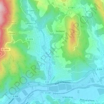
Name: Lamalou-les-Bains topographic map, elevation, terrain.
Average elevation: 258 m
Minimum elevation: 166 m
Maximum elevation: 537 m
Other topographic maps
Click on a map to view its topography, its elevation and its terrain.
La Petite Motte
France > Occitania > Hérault > La Grande-Motte > La Petite Motte
Average elevation: 1 m