
Thank you for supporting this site ❤️
Make a donation
Make a donation
Gear up for your next adventure:
As an Amazon Associate, this site earns from qualifying purchases at no extra cost to you.
ail topographic map
Click on the map to display elevation.
Thank you for supporting this site ❤️
Make a donation
Make a donation
Gear up for your next adventure:
As an Amazon Associate, this site earns from qualifying purchases at no extra cost to you.
About this map
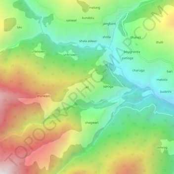
Name: ail topographic map, elevation, terrain.
Location: ail, Chaurah, Chamba District, Himachal Pradesh, India (32.81586 76.01592 32.85586 76.05592)
Average elevation: 2,092 m
Minimum elevation: 1,491 m
Maximum elevation: 2,985 m
Thank you for supporting this site ❤️
Make a donation
Make a donation
Gear up for your next adventure:
As an Amazon Associate, this site earns from qualifying purchases at no extra cost to you.