
Unterrot topographic map
Interactive map
Click on the map to display elevation.
About this map
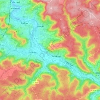
Name: Unterrot topographic map, elevation, terrain.
Average elevation: 416 m
Minimum elevation: 321 m
Maximum elevation: 517 m
Other topographic maps
Click on a map to view its topography, its elevation and its terrain.
Winzenweiler
Deutschland > Baden-Württemberg > Landkreis Schwäbisch Hall > Gaildorf
Winzenweiler, Eutendorf, Gaildorf, Verwaltungsverband Limpurger Land, Landkreis Schwäbisch Hall, Baden-Württemberg, 74405, Deutschland
Average elevation: 469 m