
Trảng Dài Ward topographic map
Interactive map
Click on the map to display elevation.
About this map
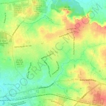
Name: Trảng Dài Ward topographic map, elevation, terrain.
Location: Trảng Dài Ward, Biên Hòa City, Đồng Nai Province, Vietnam (10.96682 106.84645 11.00580 106.90182)
Average elevation: 32 m
Minimum elevation: 0 m
Maximum elevation: 65 m
Other topographic maps
Click on a map to view its topography, its elevation and its terrain.