
île Kettle topographic map
Interactive map
Click on the map to display elevation.
About this map
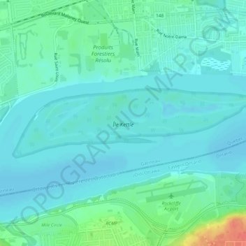
Name: île Kettle topographic map, elevation, terrain.
Location: île Kettle, Gatineau, Outaouais, Quebec, Canadá (45.46547 -75.67397 45.47466 -75.62779)
Average elevation: 50 m
Minimum elevation: 39 m
Maximum elevation: 93 m
Other topographic maps
Click on a map to view its topography, its elevation and its terrain.