Geolocate

Badaun topographic map

Click on the map to display elevation.

About this map

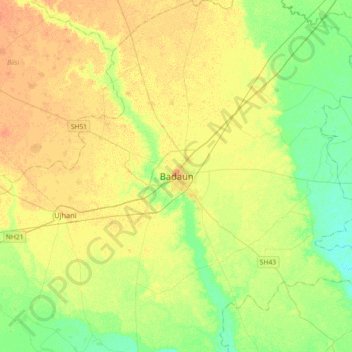
Name: Badaun topographic map, elevation, terrain.

Location: Badaun, Budaun, Badaun District, Uttar Pradesh, 243600, India (27.87670 78.96340 28.19670 79.28340)

Average elevation: 168 m

Minimum elevation: 153 m

Maximum elevation: 180 m

Gear up for your next adventure:

🎒Hiking Daypacks - Compact backpacks ideal for short hikes and excursions
📍Handheld GPS Navigators - Reliable satellite navigation for hiking and off-road exploration
🧥Packable Down Jackets - Lightweight warmth that compresses small in your bag
🔦Waterproof LED Headlamps - Hands-free lighting for evening treks and emergency navigation
🔋Lithium AA Batteries - Long-lasting power that performs well in cold mountain weather

As an Amazon Associate, this site earns from qualifying purchases at no extra cost to you.