
Khashuri topographic map
Interactive map
Click on the map to display elevation.
About this map
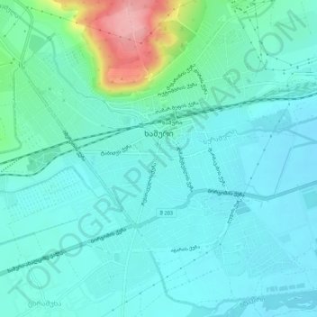
Name: Khashuri topographic map, elevation, terrain.
Location: Khashuri, Khashuri Municipality, Inner Kartli, 5700, Georgia (41.97695 43.56940 42.01133 43.62152)
Average elevation: 710 m
Minimum elevation: 685 m
Maximum elevation: 819 m
Other topographic maps
Click on a map to view its topography, its elevation and its terrain.