
Göhren topographic map
Interactive map
Click on the map to display elevation.
About this map
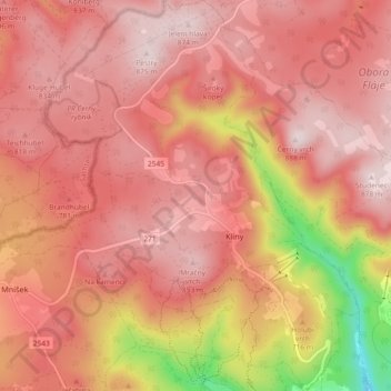
Name: Göhren topographic map, elevation, terrain.
Location: Göhren, Bezirk Brüx, Aussiger Region, Nordwesten, Tschechien (50.61195 13.51271 50.67000 13.58612)
Average elevation: 741 m
Minimum elevation: 407 m
Maximum elevation: 880 m