
Leprosy Village topographic map
Interactive map
Click on the map to display elevation.
About this map
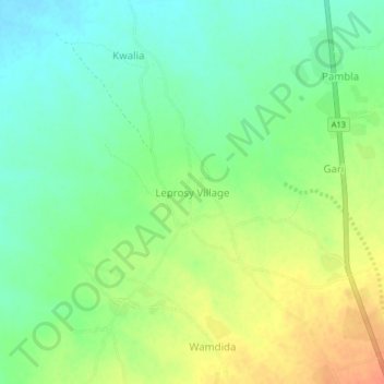
Name: Leprosy Village topographic map, elevation, terrain.
Location: Leprosy Village, Michika, Adamawa State, Nigeria (10.64837 13.35147 10.68837 13.39147)
Average elevation: 478 m
Minimum elevation: 459 m
Maximum elevation: 503 m
Other topographic maps
Click on a map to view its topography, its elevation and its terrain.