Geolocate

Mayfair topographic map

Click on the map to display elevation.

About this map

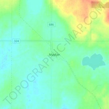
Name: Mayfair topographic map, elevation, terrain.

Location: Mayfair, Meeting Lake No. 466, Saskatchewan, Canada (52.96285 -107.61838 53.00285 -107.57838)

Average elevation: 699 m

Minimum elevation: 686 m

Maximum elevation: 728 m

Gear up for your next adventure:

📚UK Hiking Guidebooks - Detailed route descriptions for the Lake District, Peaks, and Highlands
🥤Collapsible Water Bottles - Save space in your rucksack as you consume your water
🍳Camping Stoves - Compact stoves for outdoor cooking
🎒Hiking Child Carriers - Explore the outdoors with the whole family safely
📦Dry Bags - Waterproof bags to protect gear from rain

As an Amazon Associate, this site earns from qualifying purchases at no extra cost to you.