Geolocate

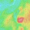
Gunter Lake topographic map

Click on the map to display elevation.

About this map

Name: Gunter Lake topographic map, elevation, terrain.

Location: Gunter Lake, Tudor and Cashel, Hastings County, Central Ontario, Ontario, Canada (44.89288 -77.54356 44.90546 -77.52967)

Average elevation: 349 m

Minimum elevation: 325 m

Maximum elevation: 379 m

Other topographic maps

Click on a map to view its topography, its elevation and its terrain.
Gunter Lake

Canada > Ontario > Hastings County > Tudor and Cashel

Average elevation: 273 m

Millbridge

Canada > Ontario > Hastings County > Tudor and Cashel

Average elevation: 285 m

Gilmour

Canada > Ontario > Hastings County > Tudor and Cashel

Average elevation: 319 m

Gear up for your next adventure:

🥤Hydration Bladders - Hands-free hydration systems for backpacks
🎒Hiking Daypacks (20L) - Compact backpacks for day trips and technical mountain ascents
🧤Thermal Touchscreen Gloves - Stay warm while operating your GPS or smartphone camera
🥼Base Layers - Thermal base layers for temperature regulation
🕶️Glacier Goggles - Maximum protection for high-altitude snow topography

As an Amazon Associate, this site earns from qualifying purchases at no extra cost to you.