
Thank you for supporting this site ❤️
Make a donation
Make a donation
Gear up for your next adventure:
As an Amazon Associate, this site earns from qualifying purchases at no extra cost to you.
Rebordondo topographic map
Click on the map to display elevation.
Thank you for supporting this site ❤️
Make a donation
Make a donation
Gear up for your next adventure:
As an Amazon Associate, this site earns from qualifying purchases at no extra cost to you.
About this map
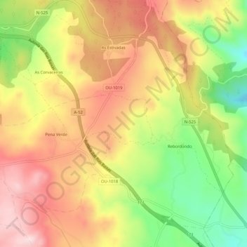
Name: Rebordondo topographic map, elevation, terrain.
Location: Rebordondo, Cualedro, Verín, Orense, Galicia, España (41.98019 -7.57969 42.01262 -7.52842)
Average elevation: 789 m
Minimum elevation: 599 m
Maximum elevation: 946 m
Thank you for supporting this site ❤️
Make a donation
Make a donation
Gear up for your next adventure:
As an Amazon Associate, this site earns from qualifying purchases at no extra cost to you.