Geolocate

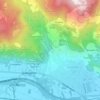
Gazzina topographic map

Click on the map to display elevation.

About this map

Name: Gazzina topographic map, elevation, terrain.

Location: Gazzina, Condove, Torino, Piemonte, 10055, Italia (45.11828 7.27393 45.15828 7.31393)

Average elevation: 987 m

Minimum elevation: 386 m

Maximum elevation: 1,618 m

Other topographic maps

Click on a map to view its topography, its elevation and its terrain.
Vasca Anti Incendio

Italia > Piemonte > Torino > Condove > Giagli

Average elevation: 582 m

Gear up for your next adventure:

📱Phone Mounts for Hiking - Secure mounts to carry your phone on trails
🧺Microfibre Travel Towels - Fast-drying and compact towels for wild swimming and camping
🐕Dog Hiking Gear - Equipment for hiking safely with dogs
🚲Bikepacking Frame Bags - Storage for tools and navigation gear on long off-road rides
🧺Ultralight Dry Bags - Organize and waterproof your gear inside your rucksack

As an Amazon Associate, this site earns from qualifying purchases at no extra cost to you.