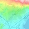
Gavar topographic map
Click on the map to display elevation.
Gavar
The people of Gavar are mainly Christians and belong to the Armenian Apostolic Church. The town has many medieval chapels and churches. The Surp Karapet Church of 1848 is among the well-preserved churches in Gavar. The Cathedral of the Holy Mother of God in Gavar is the seat of the Diocese of Gegharkunik of the Armenian Church. It was built in 1905 at the central square of the town, with the efforts of then-bishop Khoren Muradbegian with help of the local citizens. Until the late 1990s, it was the highest church in Armenia in terms of altitudes.
About this map

Name: Gavar topographic map, elevation, terrain.
Location: Gavar, Gavar community, Gegharkunik Province, 1201, Armenia (40.33720 45.10328 40.37672 45.15760)
Average elevation: 1,978 m
Minimum elevation: 1,926 m
Maximum elevation: 2,041 m
Other topographic maps
Click on a map to view its topography, its elevation and its terrain.


Vardenis
Armenia > Gegharkunik Province
Located in the valley of the Masrik River at an elevation of 2006 meters above sea level, Vardenis is dominated by the 82-kilometre (51 mi) range of Vardenis Mountains. The highest peak of the range is Mount Vardenis at 3,522 metres (11,555 ft) above sea level, located around 23 km southwest of Vardenis town.…
Average elevation: 1,949 m
Vardenis
Armenia > Gegharkunik Province
Located in the valley of the Masrik River at an elevation of 2006 meters above sea level, Vardenis is dominated by the 82-kilometre (51 mi) range of Vardenis Mountains. The highest peak of the range is Mount Vardenis at 3,522 metres (11,555 ft) above sea level, located around 23 km southwest of Vardenis town.…
Average elevation: 1,949 m