
Ban Na Chom Thian topographic map
Interactive map
Click on the map to display elevation.
About this map
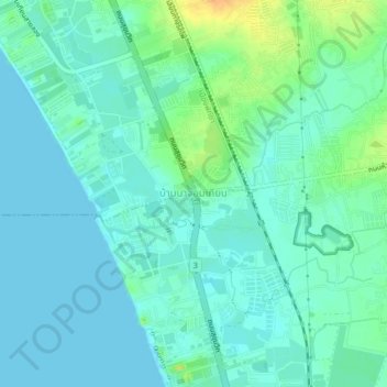
Name: Ban Na Chom Thian topographic map, elevation, terrain.
Average elevation: 8 m
Minimum elevation: -1 m
Maximum elevation: 33 m
Other topographic maps
Click on a map to view its topography, its elevation and its terrain.
รัญญจันท์เพลส
Thailand > Chon Buri Province > Pattaya City > รัญญจันท์เพลส
รัญญจันท์เพลส, Pattaya City, Chon Buri Province, 20150, Thailand
Average elevation: 21 m