Geolocate

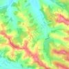
Riscle topographic map

Click on the map to display elevation.

About this map

Name: Riscle topographic map, elevation, terrain.

Location: Riscle, Mirande, Gers, Occitania, Metropolitan France, 32400, France (43.60563 -0.12653 43.67310 -0.02864)

Average elevation: 128 m

Minimum elevation: 96 m

Maximum elevation: 235 m

Other topographic maps

Click on a map to view its topography, its elevation and its terrain.

Le Tourmalet

France > Occitania > Gers > Saint-Pierre-d'Aubézies

Average elevation: 173 m

Tucon

France > Occitania > Gers > Gazax-et-Baccarisse > Gazax

Average elevation: 196 m

Gaugens

France > Occitania > Gers > Ordan-Larroque

Average elevation: 196 m

Lamaison

France > Occitania > Gers > Tournan

Average elevation: 250 m

Tucon

France > Occitania > Gers > Gazax-et-Baccarisse

Average elevation: 196 m

Loc

France > Occitania > Gers > Caupenne-d'Armagnac

Average elevation: 108 m

Balarin

France > Occitania > Gers > Montréal

Average elevation: 128 m

Gear up for your next adventure:

🎒Hiking Child Carriers - Explore the outdoors with the whole family safely
🧵Survival Paracord - Multi-purpose cordage for emergency repairs and shelters
🕶️Polarized Sunglasses - Reduces glare from snow and water when reading terrain
🧭Professional Hiking Compasses - High-precision liquid-filled compasses for map reading and orientation
🎒Backpack Rain Covers - Universal waterproof covers to protect your gear from downpours

As an Amazon Associate, this site earns from qualifying purchases at no extra cost to you.