
Linden topographic map
Interactive map
Click on the map to display elevation.
About this map
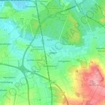
Name: Linden topographic map, elevation, terrain.
Location: Linden, Landkreis Gießen, Hessen, 35440, Deutschland (50.50238 8.61622 50.56441 8.71137)
Average elevation: 194 m
Minimum elevation: 152 m
Maximum elevation: 289 m
Die Statistisch-topographisch-historische Beschreibung des Großherzogthums Hessen berichtet 1830 über Großenlinden:
Other topographic maps
Click on a map to view its topography, its elevation and its terrain.
Bergwerkswald
Deutschland > Hessen > Landkreis Gießen > Linden > Oberhof
Bergwerkswald, Großen-Linden, Oberhof, Linden, Landkreis Gießen, Hessen, 35440, Deutschland
Average elevation: 186 m