

Teide topographic map
Click on the map to display elevation.
Teide
Teide, or Mount Teide, (Spanish: El Teide, Pico del Teide, pronounced [ˈpiko ðel ˈtejðe], "Peak of Teide") is a volcano on Tenerife in the Canary Islands, Spain. Its summit (at 3,715 m (12,188 ft)) is the highest point in Spain and the highest point above sea level in the islands of the Atlantic. If measured from the ocean floor, its height of 7,500 m (24,600 ft) makes Teide the third-highest volcano in the world, UNESCO and NASA rank it as Earth's third-tallest volcanic structure. Teide's elevation above sea level makes Tenerife the tenth highest island in the world.
About this map
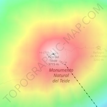
Name: Teide topographic map, elevation, terrain.
Average elevation: 3,200 m
Minimum elevation: 2,591 m
Maximum elevation: 3,703 m