
St. John's topographic map
Interactive map
Click on the map to display elevation.
About this map
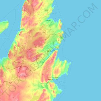
Name: St. John's topographic map, elevation, terrain.
Average elevation: 66 m
Minimum elevation: -1 m
Maximum elevation: 272 m
Other topographic maps
Click on a map to view its topography, its elevation and its terrain.
Mobile River
Kanada > Neufundland und Labrador > St. John's
Mobile River, St. John's, Neufundland und Labrador, Kanada
Average elevation: 74 m