
Little Barrier Island topographic map
Interactive map
Click on the map to display elevation.
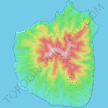
Little Barrier Island
The island is steeply sloping, and deeply dissected by ravines radiating from a central range that peaks at Mount Hauturu whose altitude is 722 m (2,369 ft). Te Titoki Point is the only area of flat land on the island.
About this map
Name: Little Barrier Island topographic map, elevation, terrain.
Average elevation: 145 m
Minimum elevation: -2 m
Maximum elevation: 677 m