Geolocate

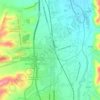
Zumpano topographic map

Click on the map to display elevation.

About this map

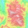
Name: Zumpano topographic map, elevation, terrain.

Location: Zumpano, Cosenza, Calabria, Italy (39.30026 16.25772 39.33831 16.30058)

Average elevation: 427 m

Minimum elevation: 189 m

Maximum elevation: 816 m

Other topographic maps

Click on a map to view its topography, its elevation and its terrain.
Sila National Park

Italy > Calabria > Cosenza

Average elevation: 894 m

Sibari

Italy > Calabria > Cosenza > Cassano all'Ionio > Sibari

Average elevation: 7 m

Quattromiglia

Italy > Calabria > Cosenza > Rende

Average elevation: 193 m

Corigliano Calabro

Italy > Calabria > Cosenza

Average elevation: 231 m

Lago Tarsia

Italy > Calabria > Cosenza > Tarsia

Average elevation: 138 m

Trenta

Italy > Calabria > Cosenza

Trenta is a town high in the Crati river Valley. The town's ancient name, Triginta, derives from the Latin number triginta or thirty. Trenta was founded by Cosentine refugees in the 10th century AD, in the era of Saracen occupations of the nearby capital, Magli, which eventually became one of the…

Average elevation: 560 m

Gear up for your next adventure:

🎒Multi-day Trekking Packs - Large capacity backpacks for wild camping and long-distance trails
🧺Microfibre Travel Towels - Fast-drying and compact towels for wild swimming and camping
🧷Tenacious Repair Tape - Instant fix for torn tents, jackets, or dry bags
🥫Expedition Meals - Lightweight, high-calorie nutrition for long-distance hikers
🔋Solar Power Banks - Keep your GPS and phone charged during multi-day expeditions

As an Amazon Associate, this site earns from qualifying purchases at no extra cost to you.