
Harmsdorf topographic map
Interactive map
Click on the map to display elevation.
About this map
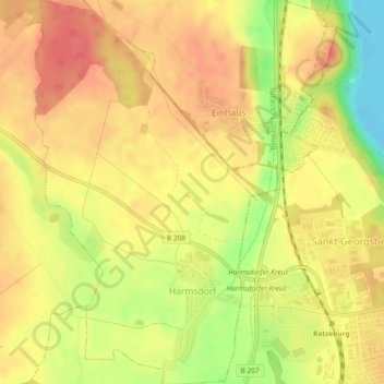
Name: Harmsdorf topographic map, elevation, terrain.
Average elevation: 39 m
Minimum elevation: 0 m
Maximum elevation: 60 m
Other topographic maps
Click on a map to view its topography, its elevation and its terrain.
Seedorf
Deutschland > Schleswig-Holstein > Herzogtum Lauenburg
Seedorf, Lauenburgische Seen, Herzogtum Lauenburg, Schleswig-Holstein, 23883, Deutschland
Average elevation: 43 m