Geolocate

Otopeni topographic map

Click on the map to display elevation.

About this map
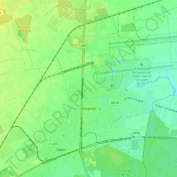
Name: Otopeni topographic map, elevation, terrain.

Location: Otopeni, Ilfov, Romania (44.52355 26.02682 44.59401 26.12324)

Average elevation: 96 m

Minimum elevation: 87 m

Maximum elevation: 105 m

Other topographic maps

Click on a map to view its topography, its elevation and its terrain.

Piscu

Romania > Ilfov

Average elevation: 106 m

Căldăraru

Romania > Ilfov

Average elevation: 59 m

Odăile

Romania > Ilfov > Otopeni

Average elevation: 96 m

Petrești

Romania > Ilfov

Average elevation: 98 m

Fundeni - Dobroești

Romania > Ilfov

Average elevation: 77 m

Ciofliceni

Romania > Ilfov

Average elevation: 95 m

Lacul Morii

Romania > Ilfov > Bucharest

Average elevation: 85 m

Dragomirești-Deal

Romania > Ilfov

Average elevation: 96 m

Odăile

Romania > Ilfov > Otopeni

Average elevation: 96 m

Căciulați

Romania > Ilfov

Average elevation: 90 m

Rudeni

Romania > Ilfov > Chitila

Average elevation: 93 m

Dumitrana

Romania > Ilfov > Măgurele

Average elevation: 72 m

Islaz

Romania > Ilfov

Average elevation: 73 m

Ghermănești

Romania > Ilfov

Average elevation: 94 m

Căciulați

Romania > Ilfov

Average elevation: 90 m

Ordoreanu

Romania > Ilfov

Average elevation: 86 m

Moara Vlăsiei

Romania > Ilfov > Moara Vlăsiei

Average elevation: 87 m

Gear up for your next adventure:

👕Merino Base Layers - Natural temperature regulation for cold weather hiking and camping
🛰️Outdoor GPS Navigation - Navigation devices for remote and off-grid areas
🛑Emergency Bivvy Bags - Heat-reflective survival bags for unexpected nights out
🦶Anti-Blister Balms - Protect your feet before long topographic expeditions
🍲Portable Camping Stoves - Fast-boiling stoves for hot meals on remote topographic survey trips

As an Amazon Associate, this site earns from qualifying purchases at no extra cost to you.