
Lac de Morat topographic map
Interactive map
Click on the map to display elevation.
About this map
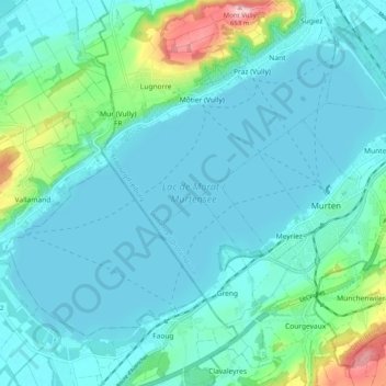
Name: Lac de Morat topographic map, elevation, terrain.
Location: Lac de Morat, Mont-Vully, District du Lac, Fribourg, Suisse (46.90442 7.03165 46.95796 7.13371)
Average elevation: 460 m
Minimum elevation: 422 m
Maximum elevation: 654 m
Other topographic maps
Click on a map to view its topography, its elevation and its terrain.