
Chiriguaná topographic map
Interactive map
Click on the map to display elevation.
About this map
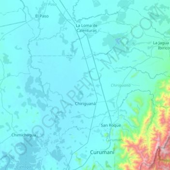
Name: Chiriguaná topographic map, elevation, terrain.
Location: Chiriguaná, Cesar, Colombia (9.24079 -73.78954 9.61020 -73.20729)
Average elevation: 154 m
Minimum elevation: 18 m
Maximum elevation: 2,211 m
Other topographic maps
Click on a map to view its topography, its elevation and its terrain.